Part 10. California-bound

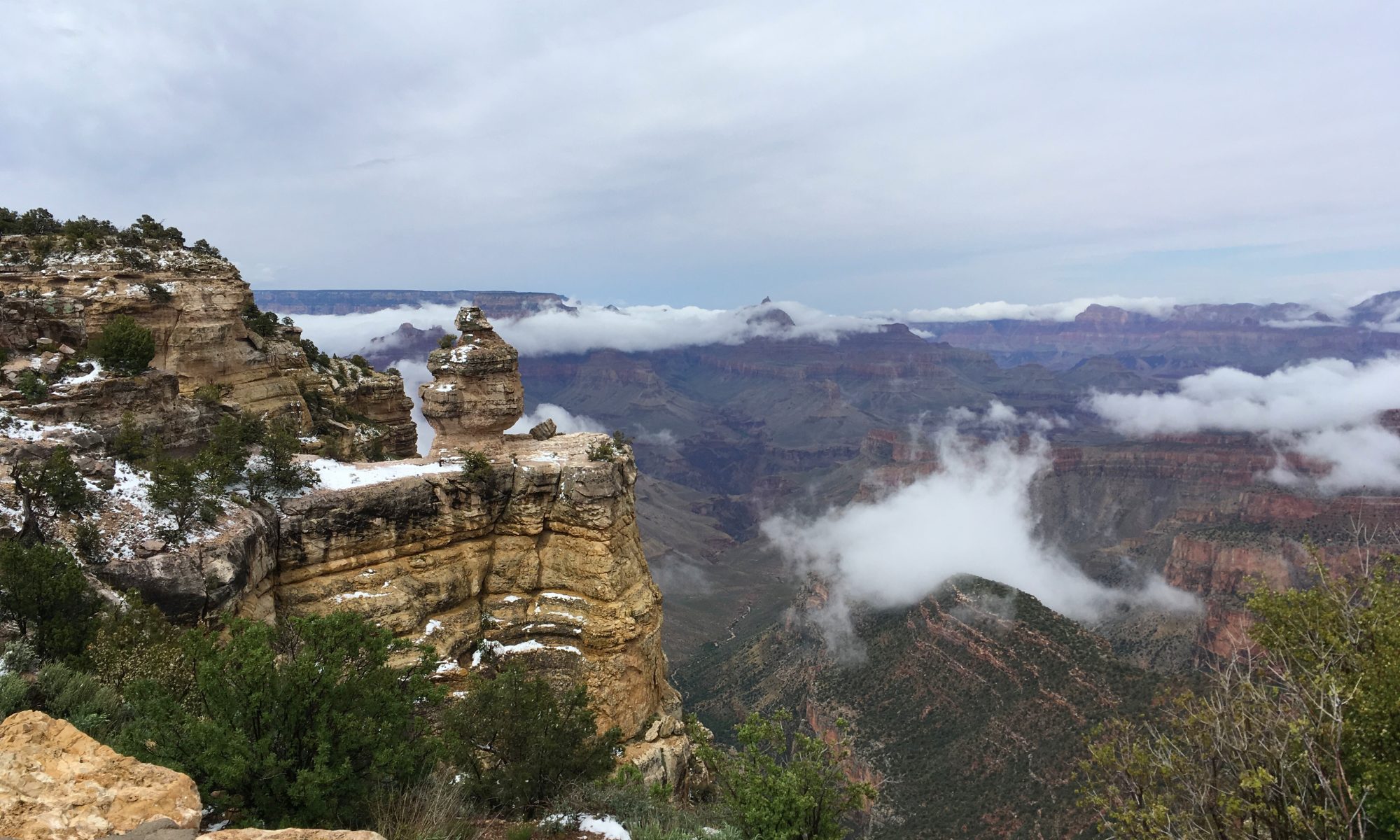
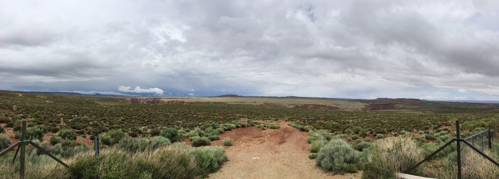
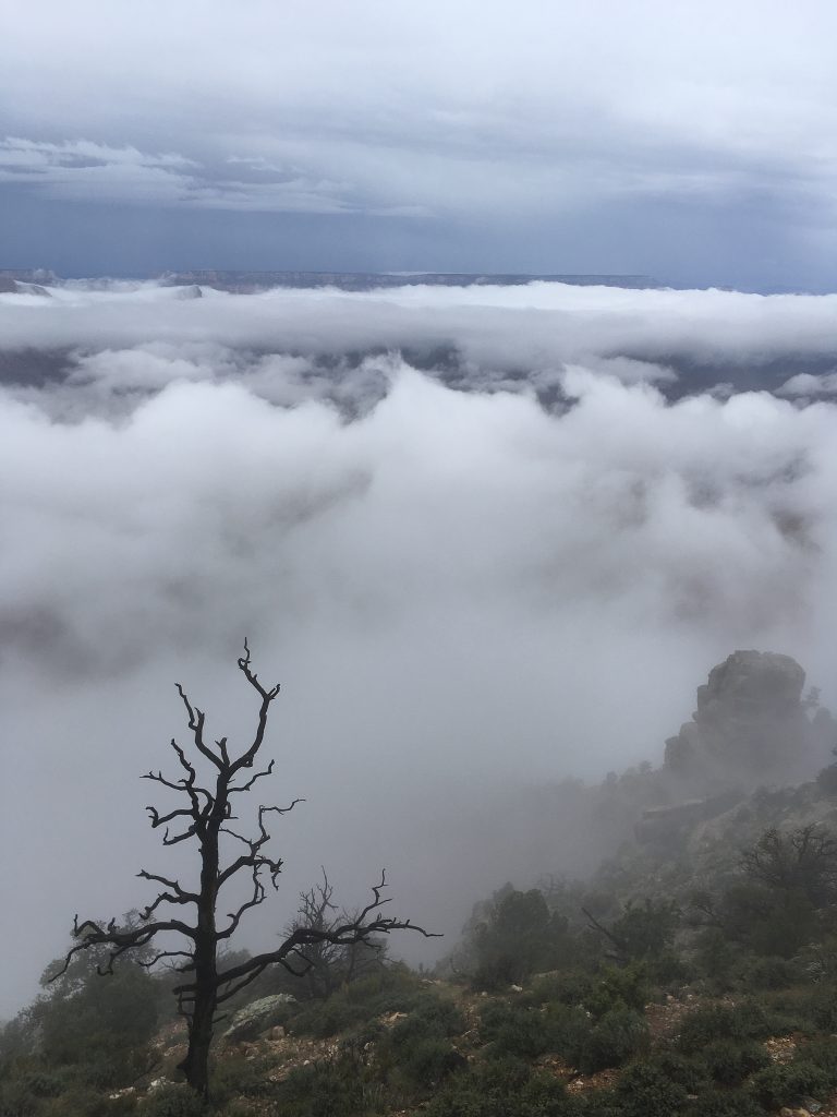
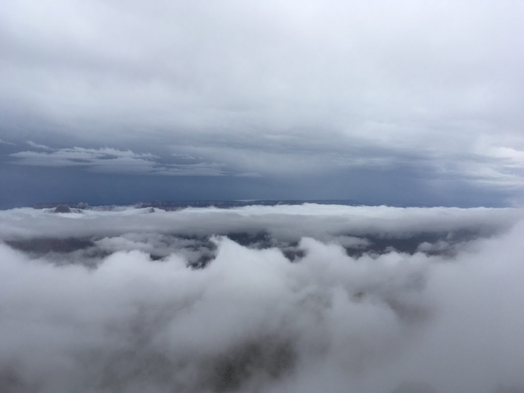
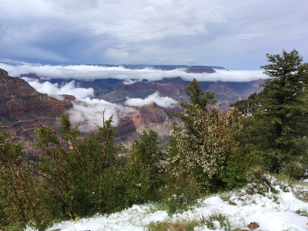
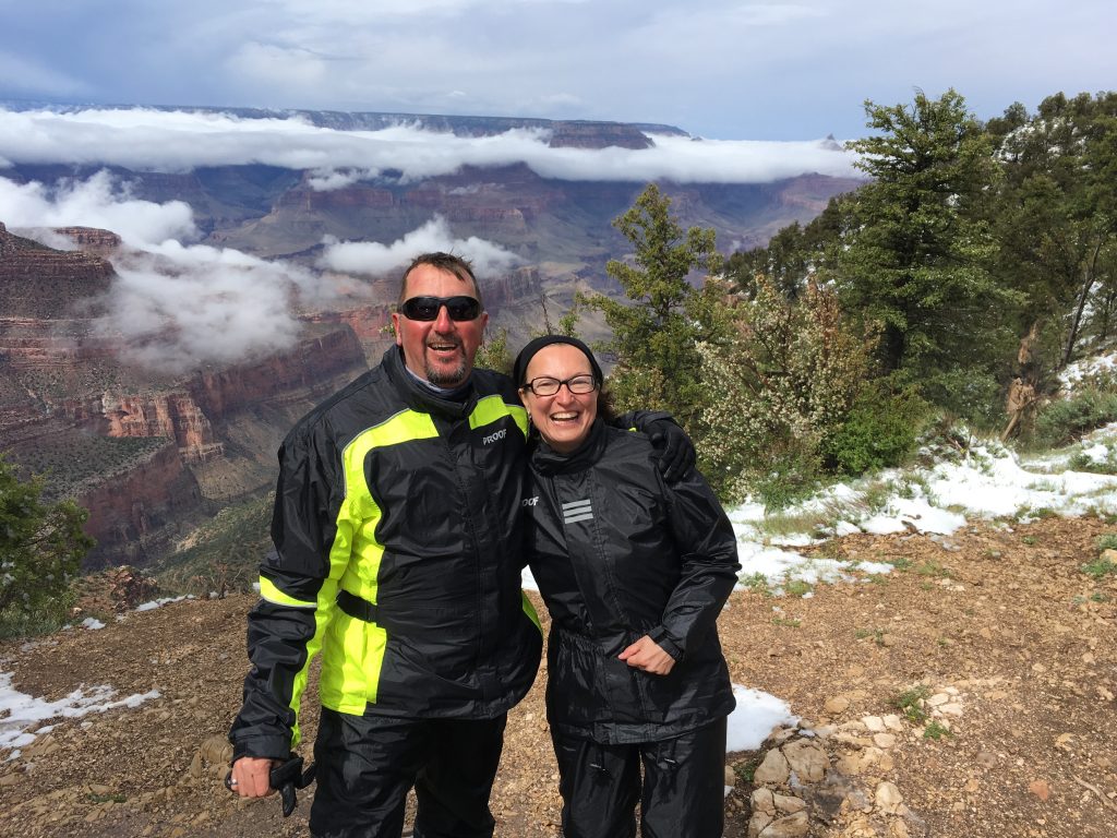
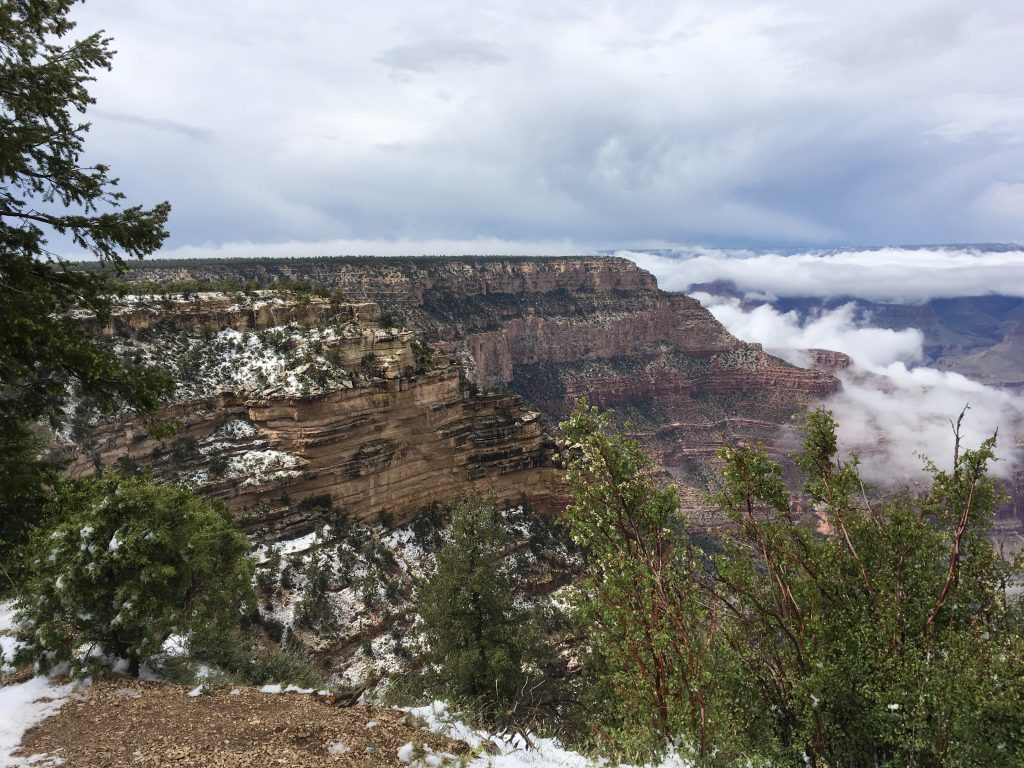
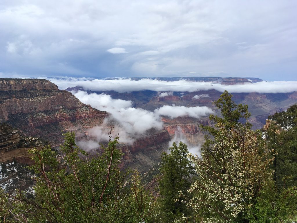
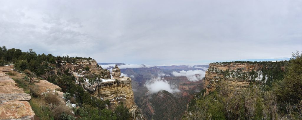
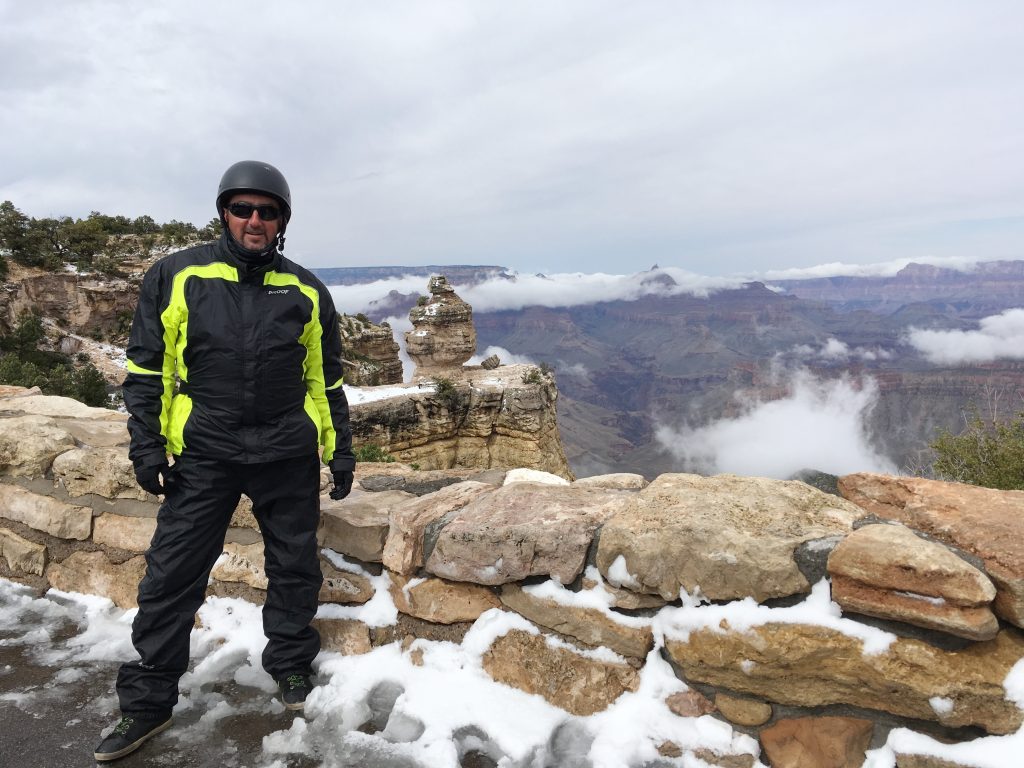
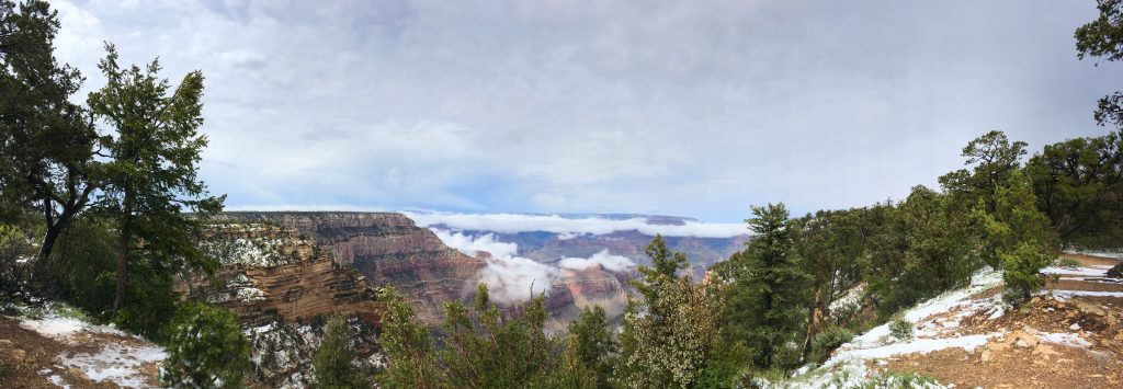
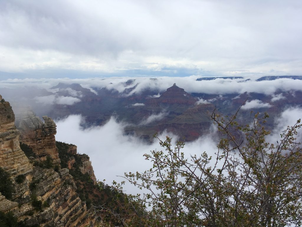
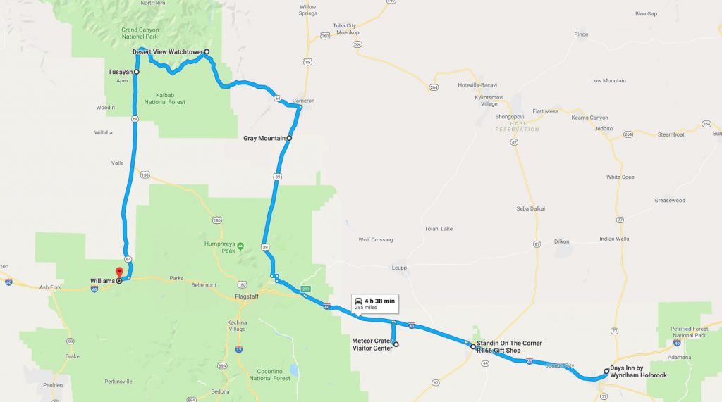
We woke up the next day to clear blue skies, sun and piercing cold.  The bikes had a thin layer of frost on them.  What the hell?….  It was the middle of May, for fuck’s sake!  Whatever…  After all the cataclysms we’ve been through on this trip, a little bit of frost would not scare us away, especially so close to the end point of our trip – the warm California!  We stoically scraped the unwanted ice off the bikes, and took a quick 40-minute dash on the Interstate to Seligman, AZ.


Angel & Wilma Delgadillo’s Shop

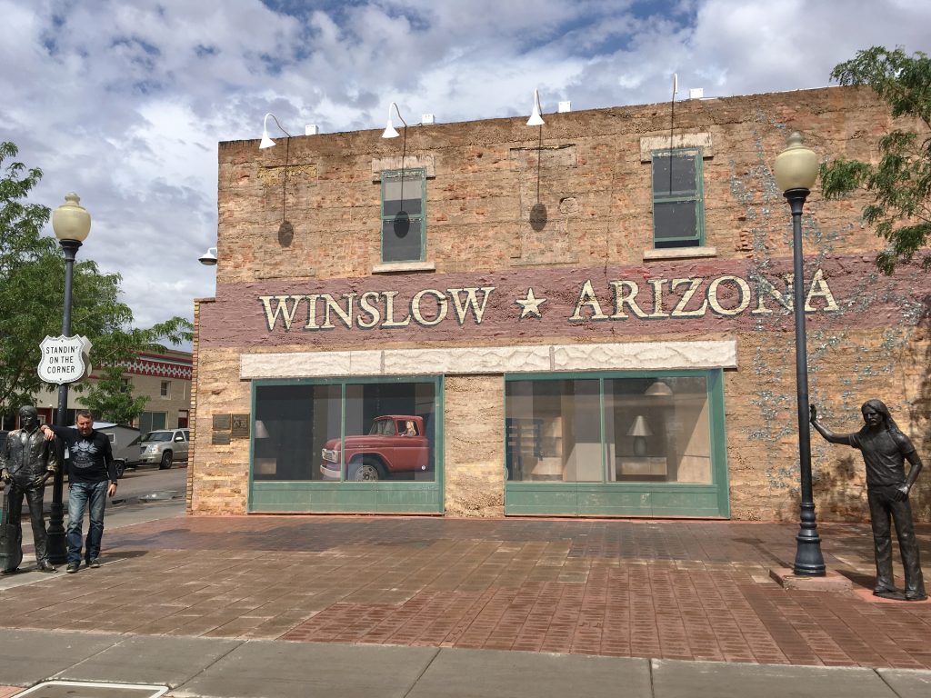
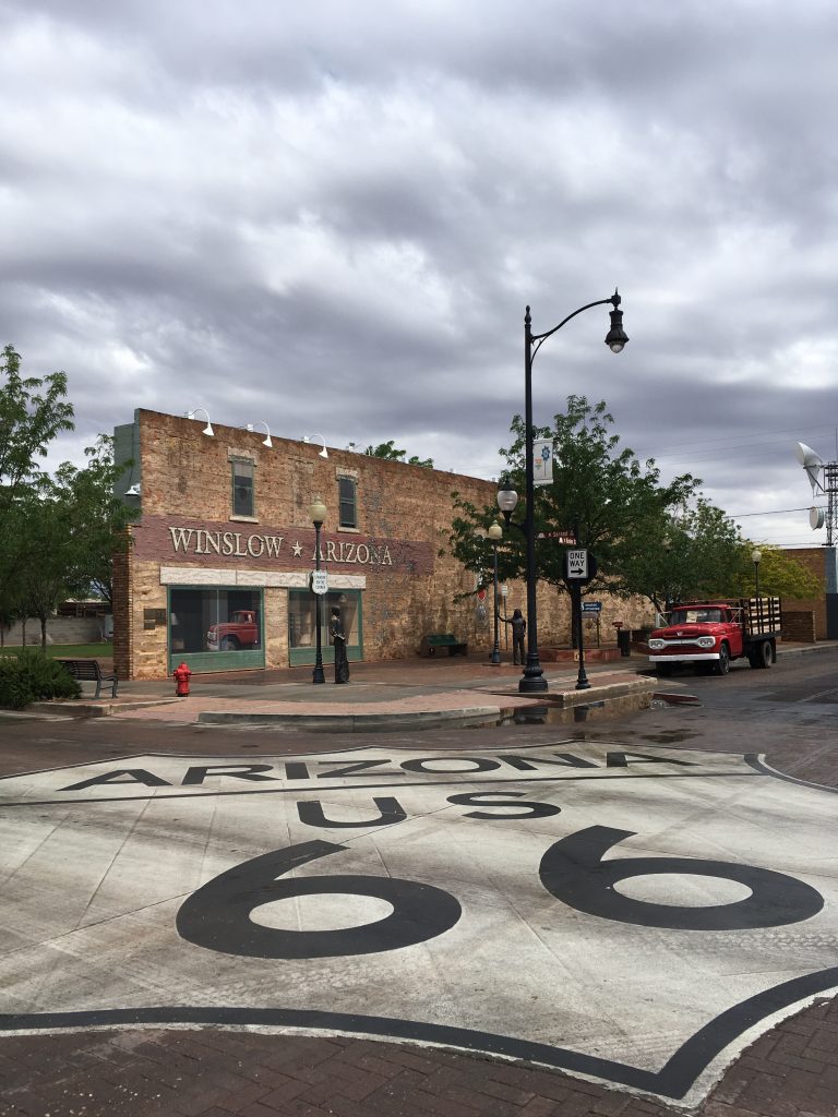
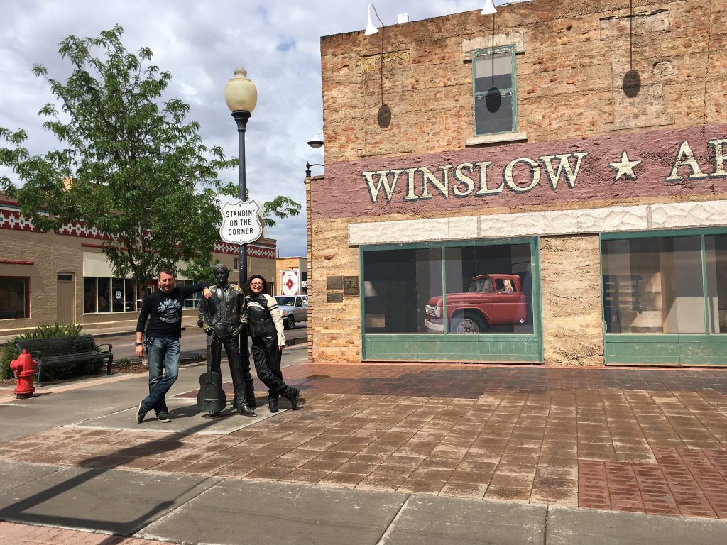
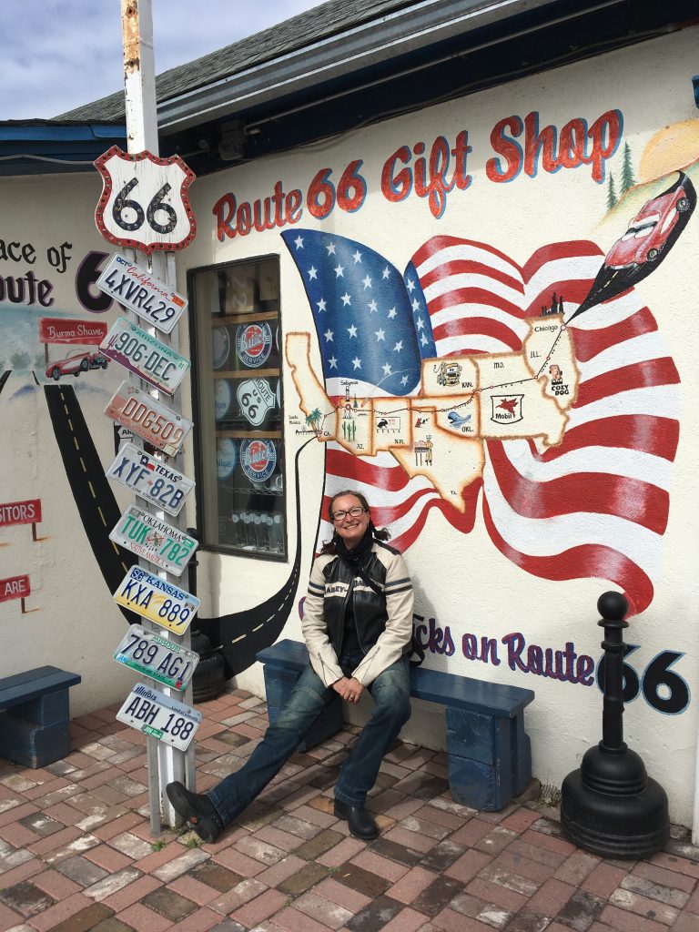
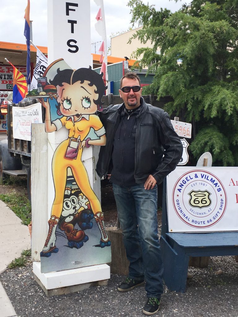
Although initially we only had one place in Seligman marked on our route planner, Angel & Wilma Delgadillo’s Shop, the town turned out to be an absolute Route 66 goldmine, full to the brim with quirky memorabilia.  But all in its turn. 

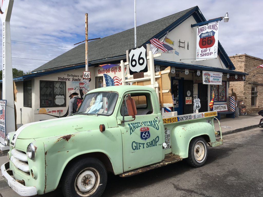
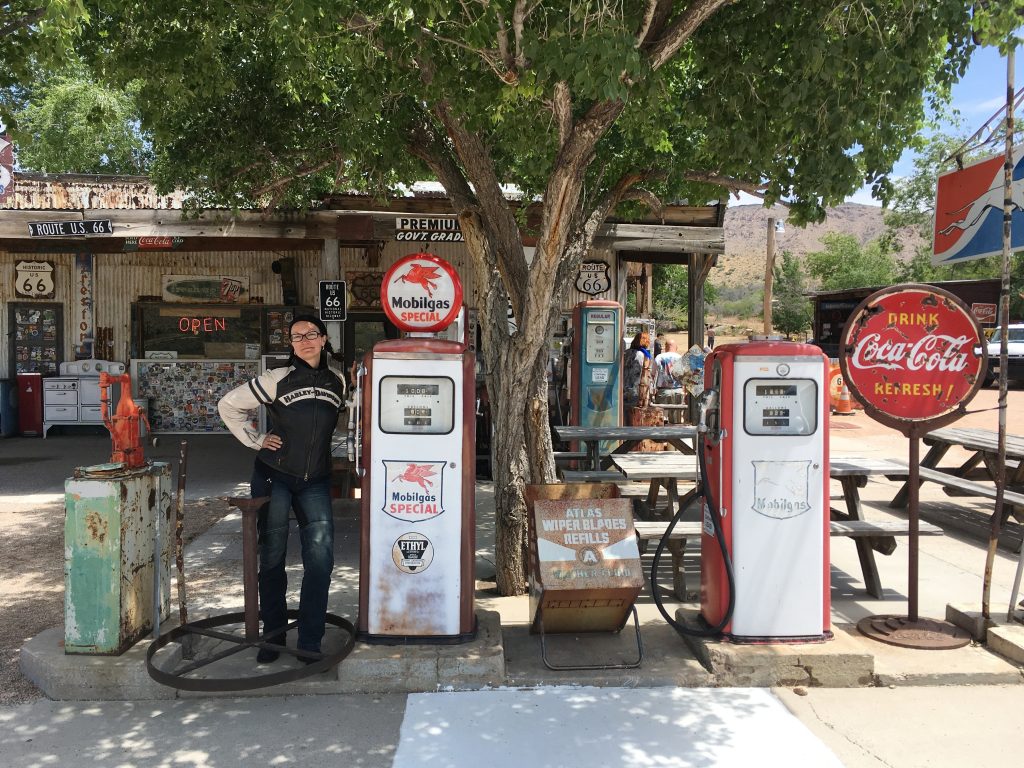
Angel & Wilma Delgadillo’s Shop, the first ever gift shop on Route 66 started out of the owners’ barber shop and pool hall, which in itself would have been enough to make it stand out.  However, the gift shop part was just a side effect of a much more colorful, interesting and proud story of Angel Delgadillo – a native of Seligman, who has lived there ever since 1927, and to whom, in all honesty, Route 66 probably owes the fact that it still exists in people’s memories and is going strong as one of America’s main landmarks.  Seeing the devastation and distress that the opening of Interstate 40 brought to his previously thriving town in 1978, Angel brought together small business owners of Seligman and other Arizona towns along the former historic Route, and in 1987 founded the Historic Route 66 Association, becoming its president.  Through campaigning and lobbying, by November 1987 the Association managed to have the State of Arizona officially christen the stretch of US-66 between Seligman and Kingman as “Historic Route 66”.  By making this stretch historic, Arizona preserved 159 miles of the route, which remains the longest uninterrupted stretch of Route 66 in the country.  And that was just the beginning!…

The freshly-awakened public nostalgia for The Neon Highway helped Angel and the Historic Route 66 Association in their efforts.  They organized car rallies and events, invited celebrities and promoted the Mother Road every way they could.  Eventually, seeing the rising interest in Route 66 memorabilia, Angel converted his barber shop and pool hall into the gift shop.  His father’s 1926 barber chair he had been using for work ever since graduating from the American Barber College in Pasadena, CA still occupied an honorary place in the corner.  Seligman has since become known as “The Birthplace of Route 66”, and Angel acquired the respectable nicknames of “The Mayor of the Mother Road” and “The Guardian Angel of Route 66”.

Even with all the fame and attention (the gift shop is listed at the top of the must-visit places in every history- and guidebook about Route 66), at the age of 91 Angel remains a happy-go-lucky down-to-earth man, genuinely delighted with every visitor to his home-town.  He even occasionally gives shaves and haircuts in his father’s barber chair in the corner of the gift shop!

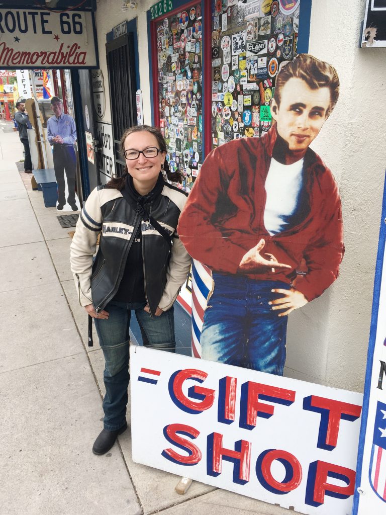
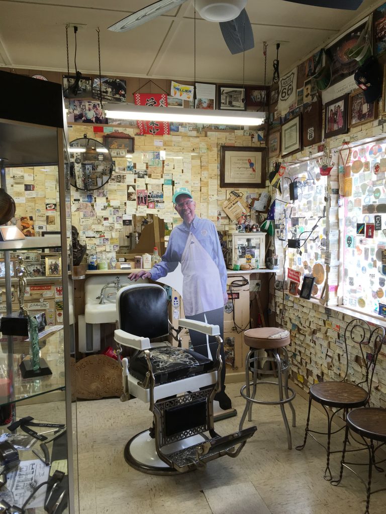
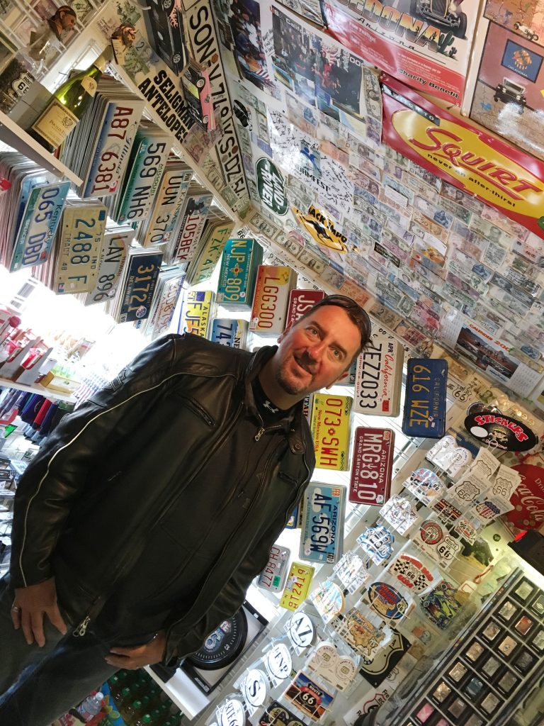
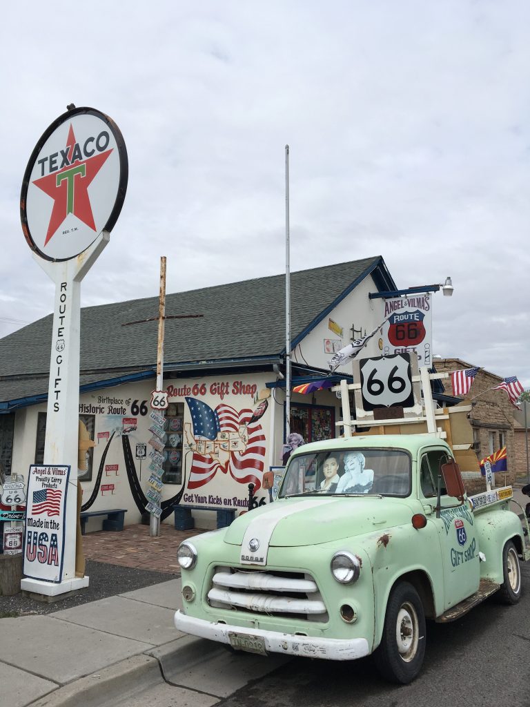
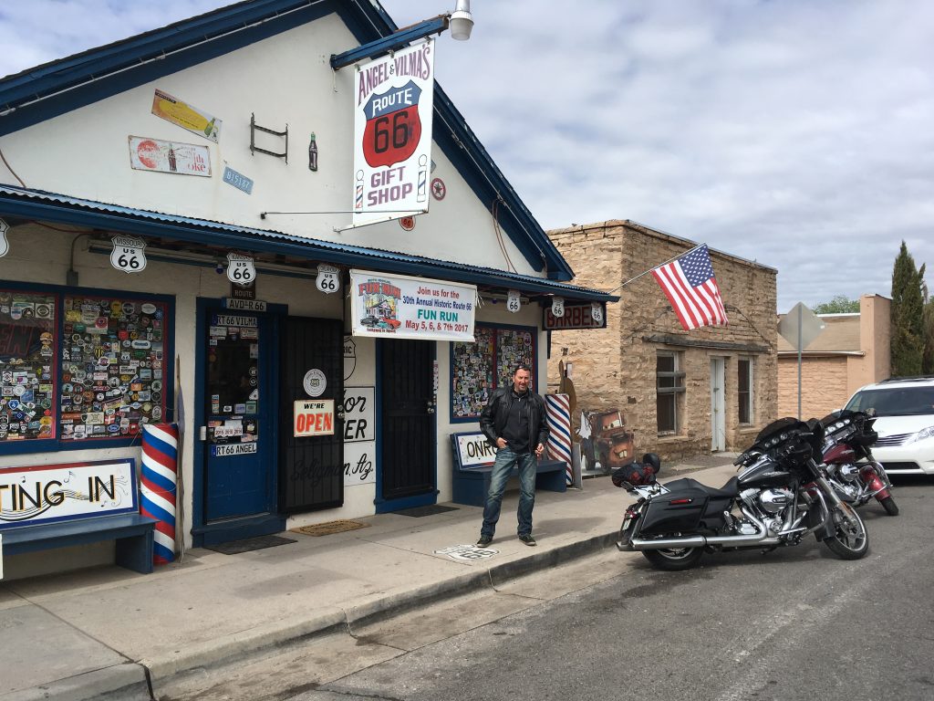
We weren’t as lucky as to see Angel in person, but were definitely glad to visit the place and honor the man, whose efforts to save his family’s and town’s livelihood turned into a rocket fuel for national and world-wide interest and revival of America’s most famous road.  The place was magic.  It looked like a time-capsule of the carefully preserved years, when the Neon Road was at the peak of its glory.  A life-size cardboard figure of Angel by the barber chair could not replace the original, but added to the general surrealism of the moment.


The Roadkill Cafe

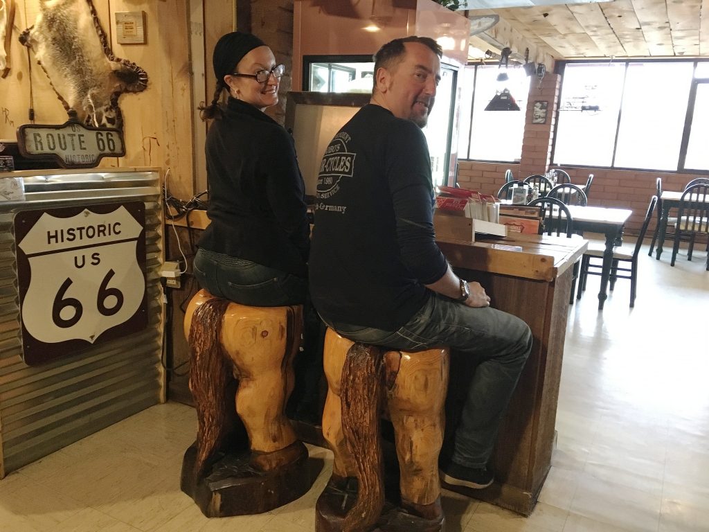
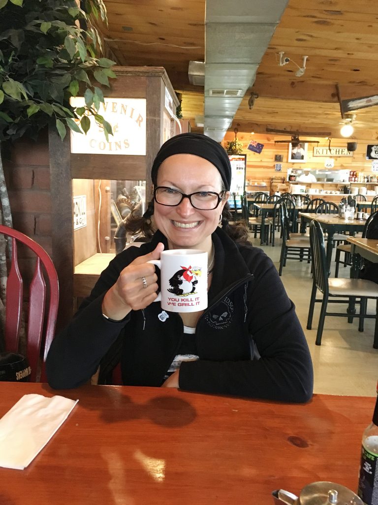
Much as we enjoyed the shop, we were more than ready for breakfast.  And we had just the place in mind – the Roadkill Café down the main road from Angel & Wilma’s shop. It was found on Google Maps last night by pure accident, and was just the place our empty stomachs and adventurous souls called for.  With a motto of “You kill it, we grill it!” how could it not?!… 

Roadkill Cafe

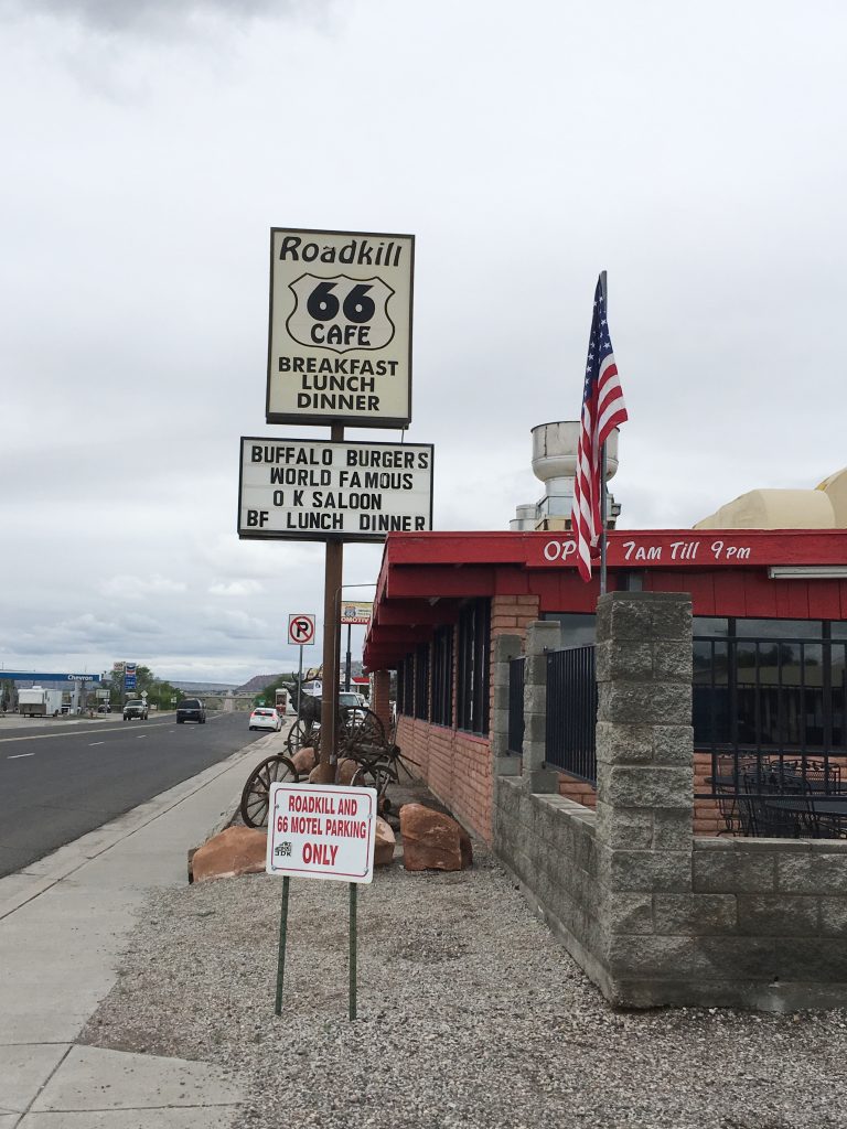
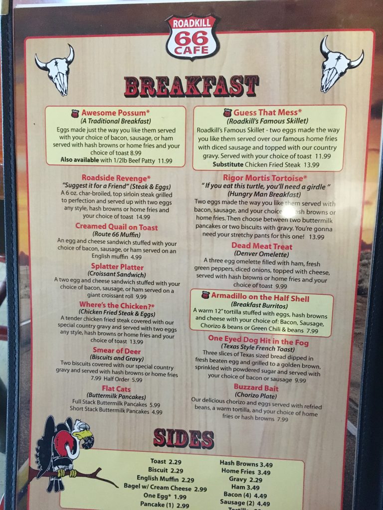
Open from 7 in the morning till 9 in the evening, and featuring such amazing dishes as “Flat Cats”, “Smear of Deer”, “Splatter Platter” and “Rigor Mortis Tortoise”, it was all we could dream of on a cold morning.  We opted for the “Awesome Possum” (for me) and “Guess that Mess” (for Nic), and in addition to smart-ass names, the food that showed up on the table without any delays was incredibly delicious.  For the squeamish ones out there – the ingredients did not really contain any possums or tortoises, but were a clever marketing call to everyone’s wild side.  We embraced ours and dug in. 

The awesome menu of the Roadkill Cafe

After an hour in this oasis, sated and thawed out, we raided the Roadkill Café’s gift shop, and became proud owners of the hungry vulture T-shirt with the cafe’s motto, a bottle of Tabasco sauce with a simple and clear name of “Death” printed on it, and a couple more nondescript, but equally craved for souvenirs.  It was time to move on…

Horsing around in the Roadkill Cafe


John Osterman’s Service Station

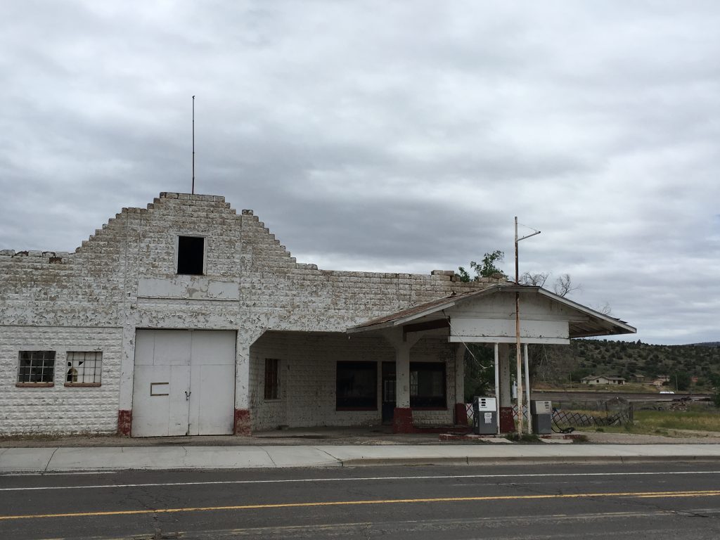
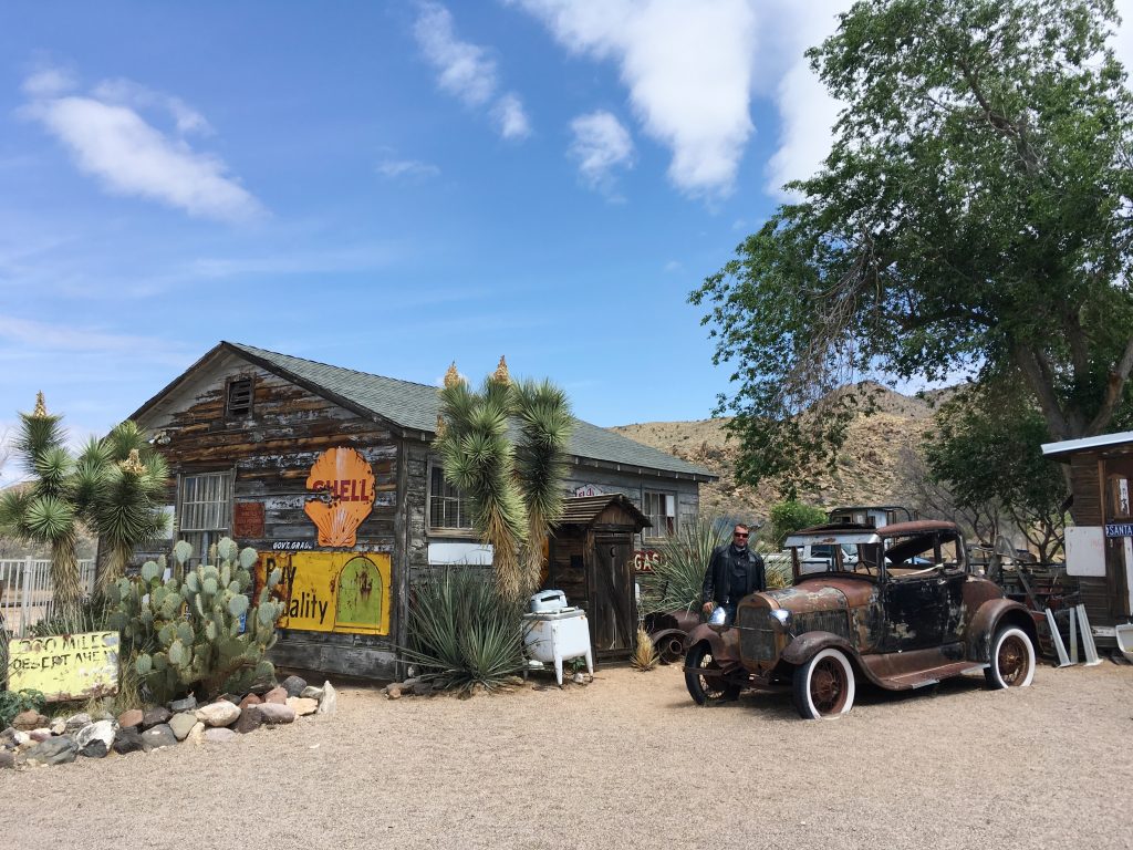
No Route 66 road trip is complete without visiting numerous abandoned places, businesses and towns that fell victim to civilization moving in in the shape of the Interstate Road system.  We missed quite a few of those due to inclement weather in the first half our trip, and were fully intent on catching up by the end of it.  John Osterman’s Service Station in Peach Springs was next on our list. 

Osterman’s Service Station in Peach Springs

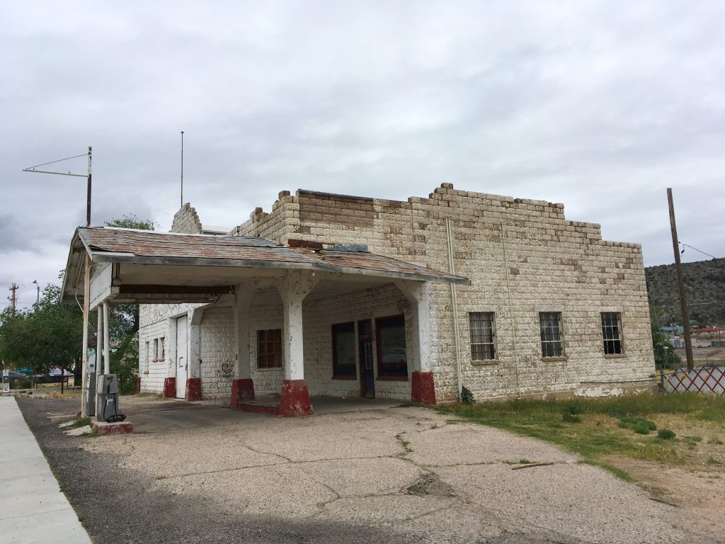
From Seligman, we avoided the Interstate and followed the Historical Route 66 through county-side.  It was still chilly, but the thoughts of the Golden State, awaiting us ahead, warmed us up.  That, and the hearty Roadkill Café breakfast, of course!  The Osterman Gas Station was, as expected, still closed, and in all honesty was not much to look at.  It obviously was not the architectural value that made it famous, but something else entirely.  Opened by a Swedish immigrant John Osterman in 1925 as a trading post and rebuilt in 1993 when the realignment of Route 66 called for a larger station with garage, the place remained in operation till 2007. 

Unlike Seligman, Peach Springs did not have much to offer.  Even though according to online sources Peach Springs remains the tribal quarters of the Hualapai Indian Reservation, only two businesses keep running – a grocery store and a post office.  We looked around, took a couple of photos, and followed the country roads to the next sight.  It was quite ironic, actually, how THE main highway of the US back in the day could only be considered a minor country track less than a century later.

Osterman’s Service Station in Peach Springs


Hackberry General Store

Hackberry General Store

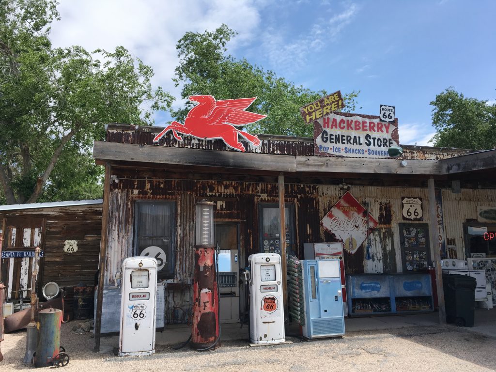
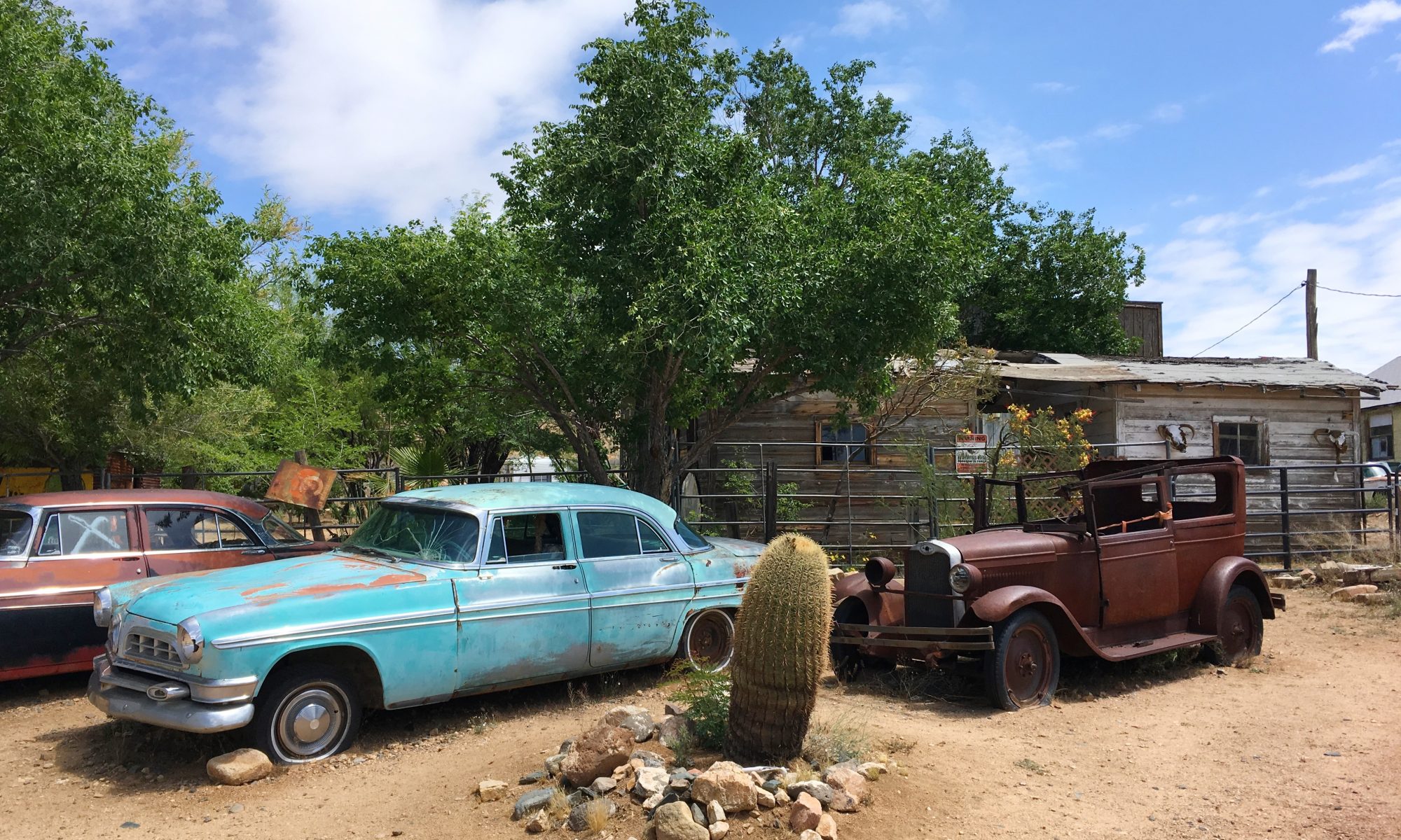
An easy 20-min cruise brought us to Hackberry General Store still in Arizona, but closing in on California border.  The place was marked as a must-see in all Route 66 guidebooks, and was right on our way anyway. 

By the Hackberry General Store

With the derelict car shells strategically positioned up front with picturesque cacti in-between, old gas pumps, and an astonishing mix of shit cramping the insides of the store, the place was hard to miss. Creepy mannequins were mixed in with old photos, rusty lamps, and mountains of miscellaneous chachka of varied levels of uselessness.  The shop was a dusty twilight labyrinth of narrow aisles and passages, leading from one cramped room to the other.  We were glad to get out, and spent most time taking photos of the exterior.

By the Hackberry General Store


Mr. D’z Route 66 Diner

Mr. D’z Route 66 Diner

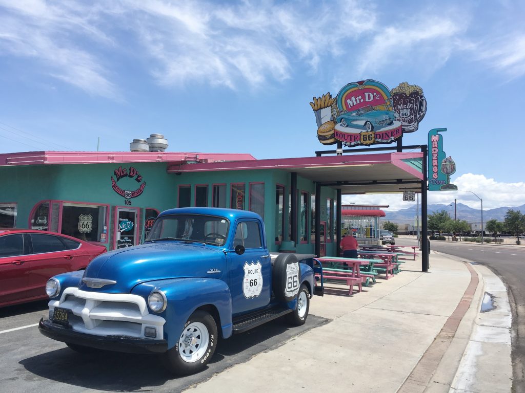
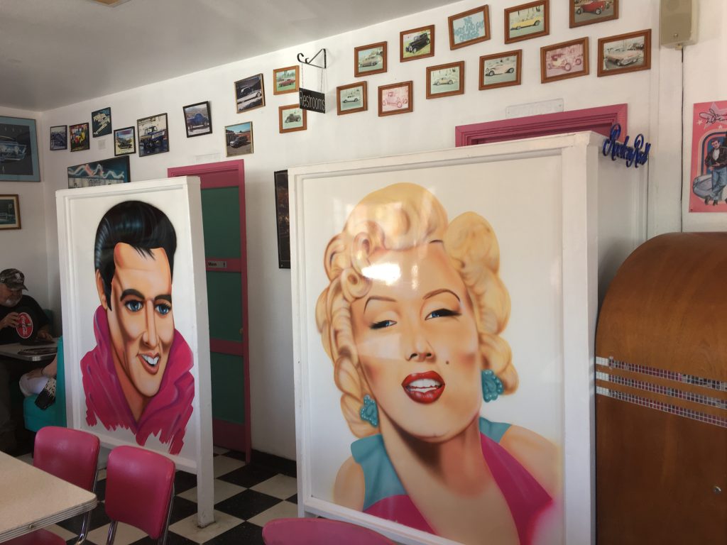
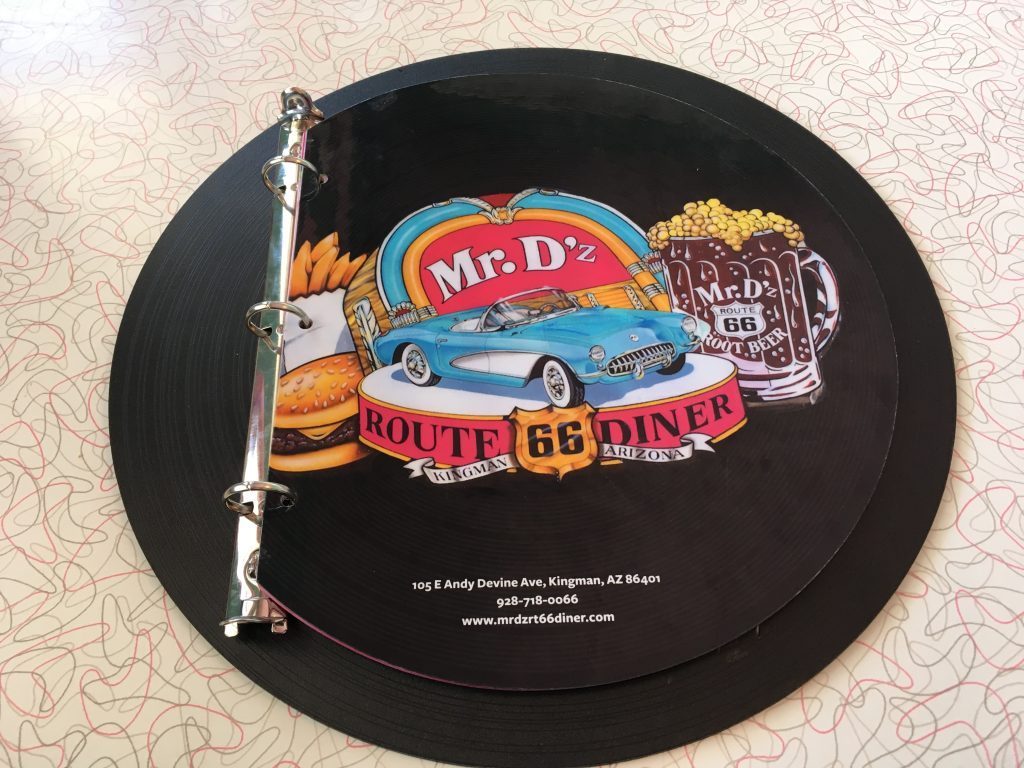
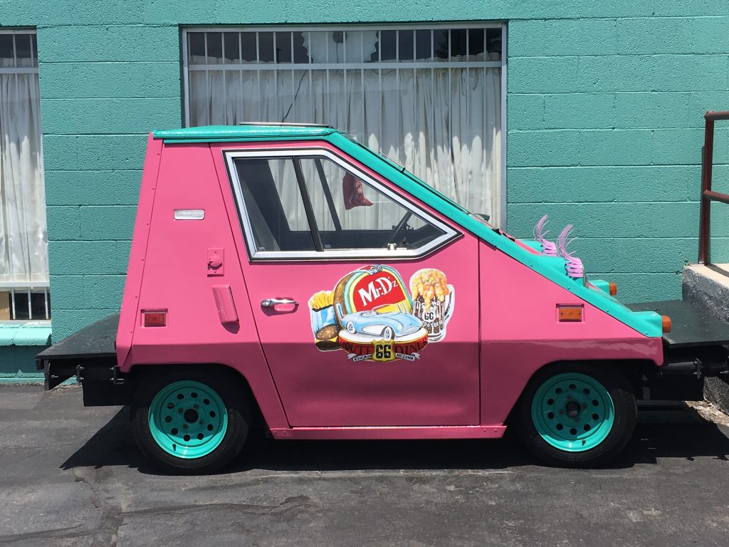
Still full of the amazing Roadkill Café breakfast fare, we did not really think about lunch.  A pit stop for drinks and a bathroom (we did not have the heart to brave the facilities at the Hackberry General Store), however, seemed like a good idea.  30 minutes down the road we found just what was needed – a bright- and welcoming-looking turquoise & pink Mr. D’z Route 66 Diner with a mint-condition old truck parked in the front.  The food looked amazing, but we could not fit any more in, and opted for 2 big teas with a slice of cake to share.  We sipped our teas, and basked in the bright and kitschy atmosphere of the quintessential Route 66 diner, in operation since 1938.  The menus were made in the style of vinyl records, the walls were peppered with colorful framed photos of old cars, pink seats were bright-colored plastic, and happy faces of Elvis and Marilyn greeted the patrons at the gents and the ladies.

Ladies & gents at Mr. D’z Route 66 Diner in Kingman, AZ

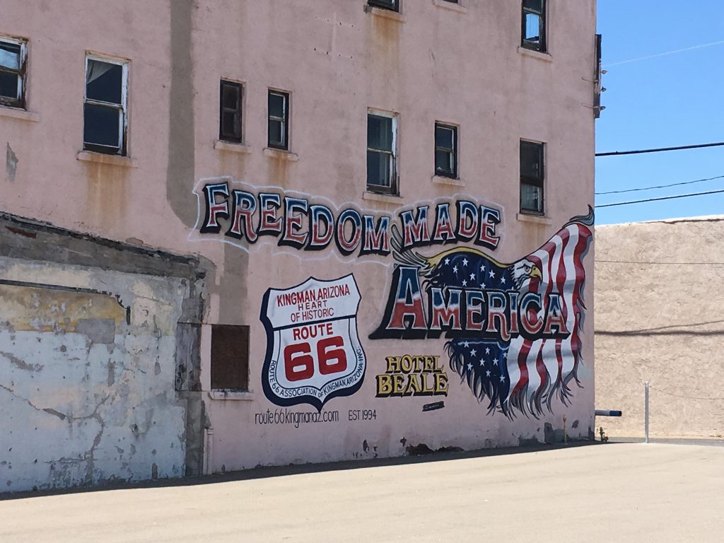
Kingman seemed much more alive and happening than even Seligman – it was also full of Route 66 memorabilia, but other business seemed to be thriving as well.  Gas stations, post offices, diners, even banks were right there, and in full operation.  The trick to Kingman’s prosperity was probably the fact that not only was it both, on the Interstate and Route 66, but also had a railroad going through the town, even having its own train station.  The place was, in fact, named after a railroad engineer, Lewis Kingman, and laying only 50 miles away from the border with sunny California remained an important connecting point between Arizona and California.  The climate was also definitely better than in the heart of Arizona.

Pie and teas in, we move on direction California.  The remaining 58 miles to Needles, CA we opted out of the Interstate, following instead the Oatman Highway, going through the beautiful Golden Valley, and then snaking down at a steady 6% angle, with each mile adding to the warmth of the surrounding environment.  By the time we crossed into California, we had to stop and take off our leathers.  It was suddenly hot.
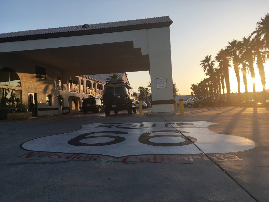

Needles, CA

Needles, CA was busy with road construction, which our ancient built-in Harley GPS refused to recognize, nearly leading us under the roller of a huge construction vehicle at some point, and causing just fury on the part of its operator and a couple of his nearby mates.  We persisted in search of accommodation.  We came prepared – we had 4 relatively central motels and hotels with addresses marked on our road map, and we were intent on finding decent digs for our stay.  Turned out, it was not so easy. 

Welcome to Needles, CA

The first place on our list, America’s Best Value Inn, represented a pile of burned out rubble that looked like an insurance claim job (successful or not, it was not our place to judge)… 
The 2nd one, a Route 66 Motel, looked more like an undercover brothel snd a drug den, than a motel per se, so we decided to give it a miss. 
The 3rd place we called upon, an Imperial 400 Motor Inn was closed down.  We started doubting ourselves. 
Luckily for us, though, #4 on the list turned out to be the charm – the Best Western Colorado River Inn hotel not only was open and looked decent, but also had a room for us, and parking for our bikes.  As a bonus, there was a diner next door, where we dragged our tired and hungry asses after a quick shower, and enjoyed a couple of drinks accompanied by a humongous salad with fried chicken.  As a healthy sign, avocado was present on the plate.  We were finally in California!

Our route from Williams, AZ to Needles, CA on Day 9 of the trip

Part 9. Corners, Craters & Canyons.

The next morning we woke up to grey skies and drizzling rain.  Shit!…  Back into rain gear (which luckily had a chance to dry out over the past couple of days), and on the road again – we were still on schedule.  I was hoping to experience Arizona in all its glory without any untoward weather phenomena, but seemed like this was not going to happen…  In addition to the annoying drizzle, the dark thunderstorm clouds of yesterday were still loitering on the horizon…  Just what one needs when crossing vast empty spaces on a motorbike!…

Standing on the Corner in Winslow, Arizona

We left Hollbrook at 08:30 and after just half an hour on the road, the drizzle turned into a torrential downpour.  This was not fun.  We had to stop.  Luckily, the next point on our itinerary was just 30 something miles away.  The town of Winslow, Arizona, not known for anything special before 1972, when one line from the Eagles’ hit “Take it Easy” skyrocketed the place to national and world fame.  After that, badly hurt by the influx of business due to creation of the I-40 bypass, the town of less than 10,000 people did it’s best to capitalize in on that one line to the full.  Standin’ on the Corner Park, consisting of a brick wall with faux windows, and a bronze figure of a man with a guitar standing on the corner of said wall and a flat-bed truck parked next to it, became the new main attraction of the place.  In 2016, after the death of Grenn Frey, who co-authored the musical masterpiece, his statue was added to the park as well – leaning on a lamp post opposite the first dude.  Without a guitar, though…

Standin’ On The Corner Park

After a couple of wrong turns (in our defense, we could barely see the signs or even the road in the pouring rain), we saw The Corner. We parked our motorized sofas nearby, and dashed into the welcoming doors of the Sipp Shoppe café with a view – right across the Standin’ on the Corner Park.  We could admire the local sights from inside a dry and warm environment, accompanied by delicious coffees and roast-beef sandwiches (breakfast!!!!), while buckets of rain were falling on the ground outside.  We could even partially take off our rain gear, and not sit in the pools of water on the lovely stools of Sipp Shoppe.  We sipped the lovely cappuccinos, enjoyed the roast-beef, and admired the view.  I made quick random dashes outside to take photos, but after half an hour, the downpour turned into a drizzle, and eventually stopped altogether. 

Winslow, Arizona

Perfect timing!  We did a quick photo-session with The Corner, and suspiciously eyeing the heavy grey clouds, threatening to burst out with the next downpour, continued on our way.

After the rain is gone…
Check out the bathtub on the roof!

Meteor Crater

The Meteor Crater

Next on the agenda – Meteor Crater, also known by a much more colorful name of a Canyon Diablo Crater, or a slightly more boring one of Barringer Meteorite Crater.  Located just 30 minutes West off Winslow, it was a place I stumbled upon by pure chance during my mad Christmas dash from St. Louis to Nevada and back and fondly remembered ever since.  Some 50,000 years ago, a meteor, relatively modest in size by meteor standards – about 50 meters (160 feet) across, but with the energy equivalent to 20 million tons (!) of TNT, landed in the Arizona High Desert, creating a crater of 1.2 km (0.7 miles) in diameter.  Because of its remote location, the crater was discovered only in the end of the 19th century, and first thought to be a remnants of a volcano.  After a dozen more years of drilling and poking around, the diagnosis changed, and those exploring the area started suspecting that the big hole in the ground might have been the result of an impact with a meteorite.  It was not until 1960-es, however, that the suspicions were confirmed, after pieces of the extra-terrestrial rock were found on premises.  The largest discovered fragment of the meteorite is now proudly displayed in the visitor’s center.

In 1960-es and 70-es the Meteor Crater was one of the sights where NASA astronauts trained to prepare for the Apollo Mission to the Moon, and an actual Apollo test capsule welcomes visitors in front of the main entrance to the facilities (to my disappointment you could not get into the capsule, though…).

The Apollo Test Capsule

Another interesting fact about the crater, is that it is privately owned.  The Crater is managed by the fourth generation of the Barringer family, whose great-grand-father made a smart investment and purchased the land surrounding the crater after no valuable minerals were discovered during excavations on site.  The family contributes to the preservation of the Crater and encourages and supports scientific exploration and research within the field of meteoritics.  They built a wonderful museum on site, and the place is absolutely worth the $18 admission fee.  With all the Meteor Crater has to offer, you can easily spend several hours exploring the place.

Which we would have done, had it not been for the menacing clouds on the horizon that kept following us.  Not big fans of being caught in a thunderstorm in the middle of the desert, we regretfully had to cut our visit short, but still spent about an hour admiring the Meteor Crater and increasing our educational levels in the museum.

The Irish luck was with us – despite looking threatening and even throwing a couple of raindrops down, the clouds restrained themselves, and we continued on our way dry and safe.

The Grand Canyon

Clouds in the Grand Canyon

While browsing through the Crater Visitor’s Center extensive gift-shop (as always, exit went directly though it), we had a choice to make – get to the nearby Flagstaff, AZ and call it a day fearing possible rain, or turning North to the Grand Canyon, and doing a quick sightseeing of this natural marvel yet today.  On the one hand, the first option would give us more time to admire the Canyon on the following day.  On the other hand, we might have better luck today, if it stays dry till the end of the day.  The gift shop had free WiFi, and having quickly checked the weather forecast we choose the first option – the rain was about to start by 18:00 in the evening, after which the temperatures on the Canyon rim would drop to below freezing.  Ice is the last thing you want to encounter on a motorbike, so considering that it was only midday when we left the Crater, we decided to chance the dash North.

The plan was to turn off I-40 at Winona, before Flagstaff, go North on US-89, and then turn West on old Highway 64 that continued all the way along the South Rim of the Grand Canyon before turning South to Williams, AZ.  This was the plan, and we expected to see the Canyon, and reach Williams before the rain came down.

The first (and last) time I experienced the Grand Canyon was in winter, back in December of 2012.  With white snow highlighting all possible shades of reds and ochres, the Canyon was majestic and unforgettable.  This time I was hoping to see it in spring bloom, which I anticipated should be even more wonderful.  Ha-ha!…  When in about 2 hours after leaving the Meteor Crater we turned onto Highway 64 and started closing in on the rim, the first snow patches started appearing on the ground.  What the fuck????….  This was as far from the spring bloom as it could be… 

The road was not frozen, but the snow patches continued to be more and more frequent, until we were riding the gooey mash of snow and water.  Soon after turning off the US-89 we rode into a cloud, and had to slow down due to seriously poor visibility.  The cloud stretched all the way to the rim, and when we first reached the Desert View Watchtower, there was absolutely zilch to be seen.  The tower itself was there, but the rest looked like a huge white cloud soup, resting inside the Canyon.  This reminded us of the first encounter with the Cliffs of Moher in Ireland – an impenetrable wall of fog, with no idea what’s behind it.

Fog in the Canyon
The Desert View Watchtower in the fog

Before getting to the Grand Canyon, Nic confessed that he was under the impression (like so many others), that to see the Canyon you need to get high up, and was being quite skeptical throughout the ride, up until we reached the Watchtower.  In fact, ever since we entered Arizona, we already were quite high above the sea level.  The mean elevation of Arizona is 1,250 m (4,100 ft) and without noticing this, we continued climbing up as we closed in on the Canyon.  The highest point of the South Rim reaches up to 2, 270 m (7,450 ft) at the far eastern end of the South Rim on the spot of the Desert View Watchtower, and the North Rim is even higher, reaching up to 2,400 m (8,000 feet).  The gradual climb gives you a deceitful feeling of surprise when you find yourself up close and personal with the Canyon – you did not expect to be as high up as you were, and when looking down into the Canyon (that is, when it is not filled with fog and clouds), you don’t expect the depth.

Snow & clouds in the Canyon

Even enveloped in clouds, the place still looked magnificent.  The fog added a mysterious and forbidding feel to the landscape.  We took some fog pictures and continued on Highway 64 along the rim at snail pace, with slush sprinkling from under our tires.  I was especially terrified, expecting to slip on every minor turn of the road and kill myself with the heavy bike.  There was nothing I could do, though, but continue, scared shitless, cursing, sweating and promising myself never to do something like this ever again.

Putting up the brave faces

We were at the Grand Canyon, though, so we made it a point to stop at every single vista point on the way.  Luckily for us, the clouds thinned out as we progressed on the way, and although the bottom of the Canyon was still nowhere to be seen, the next several vista points offered a breath-taking view of the majestic rock formations.  Again, I was seeing the Canyon in snow, but it was honestly too beautiful to complain.  The spring bloom will have to wait, I guess…  On the plus side, it was not raining!

The part of Highway 64 going along the North Rim is about 25 miles long, and under normal circumstances should take about 40 min to ride.  In our slow pace in snow, stopping to admire the beauties of nature every 10-15 minutes, it took us almost 2 hours to get from the Desert View Watchtower to the Grand Canyon Village.  It was past 4 in the afternoon, and the dusk was starting to settle.  We had to tear ourselves away from the Canyon, and turn South, following the highway past Tusayan down to Williams, AZ.

The 60 miles to Williams took us about an hour, and although the snow disappeared from the road, by the time we saw the town, the temperatures dropped seriously, and I was freezing.  My teeth were doing the Morse code, and much as I tried to hug the warm bike, I was getting colder and colder.  We stopped for gas on the outskirts of Williams, and when I confessed that I did not feel my feet or hands anymore, we rolled into the parking lot of the Day’s Inn next to the gas station, and called it a day.  It took 20 minutes in the hot shower to bring me back to resembling a semi-normal human being.  If any confirmation was needed – riding in the snow was definitely not for me!

We put on all our available clothes (personally, I was wearing about 10 layers), and walked a couple of steps from the hotel to the nearby Kicks on Route 66 diner.  To be fair, walking did not feel as cold as riding the bike, but I was not taking any chances.  The cozy diner warmed up our bodies and souls with comfortable temperatures, nice food, and Italian wine.  After dinner, I agreed to take 5 layers of clothing off, but slept in the remaining 5.  Under the warm duvet.

Our rote from Holbrook, AZ to Williams, AZ with a detour to the Grand Canyon